Skip to main contentResource added 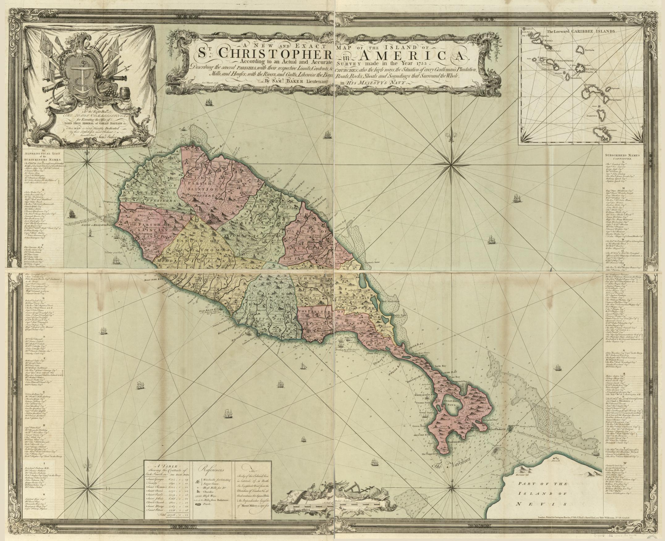
Lieutenant Sameul Baker, A New and Exact Map of the Island of St. Christopher (1753)
Figure 6.2 Lieutenant Samuel Baker, A new and exact map of the island of St. Christopher in America, according to an actual and accurate survey made in the year 1753 (1753). Hand-colored map, 115 x 142 cm. on 2 sheets 64 x 145 cm. G5042.S2 1753 .B3. Library of Congress Geography and Map Division, Washington, D.C. Image courtesy of the Library of Congress Geography and Map Division.
Comments
to view and add comments.
Annotations
No one has annotated a text with this resource yet.
- typeImage
- created on
- file formatjpg
- file size754 kB
- creatorLieutenant Samuel Baker
- creditImage courtesy of the Library of Congress